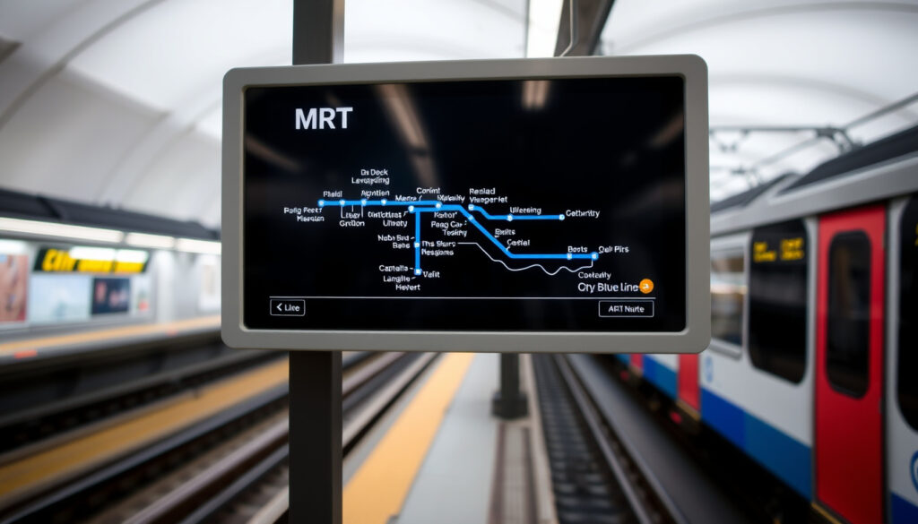
MRT Blue Line Map: Stops, PDF Download & Route Guide
There’s a reason the MRT Blue Line map is the most searched-for transit diagram in Bangkok. It’s the only metro line that circles the city’s core, linking historic Hua Lamphong with the sprawling western suburbs.
Total stations: 38 ·
Total length: 48 km (30 mi) ·
Opened: 2004 (initial section) ·
Operator: Bangkok Expressway and Metro (BEM) ·
Daily ridership (2019): ~400,000
Quick snapshot
- The MRT Blue Line has 38 stations and 48 km of track (Wikipedia).
- It connects to the BTS at Silom, Sukhumvit, and Chatuchak Park (BKK Citismart (Bangkok travel guide)).
- The official PDF map is available from the BEM website (Bangkok Transit Map (public transit resource)).
- Initial section opened 3 July 2004 (Hua Lamphong–Bang Sue) (Wikipedia).
- Last major extension: 16 December 2019 (Bang Sue–Lak Song). (Wikipedia)
- Future extensions to Phutthamonthon Sai 4 and Bang Khae are planned but not yet operational (Wikipedia).
- BEM website provides the most current version of the map. (Wikipedia)
| Attribute | Value |
|---|---|
| Full name | MRT Chaloem Ratchamongkon Line (Blue Line) |
| Operator | Bangkok Expressway and Metro (BEM) |
| Opened | 3 July 2004 (Hua Lamphong–Bang Sue) |
| Last extension | 16 December 2019 (Bang Sue–Lak Song) |
| Total length | 48 km (30 mi) |
| Number of stations | 38 |
| Daily ridership | Approximately 400,000 (2019) |
| Fare range | 16–48 THB (as of 2023) |
The pattern: this single line carries nearly half a million riders daily and is the only metro line that circles central Bangkok.
What is the MRT Blue Line map?
Overview of the MRT Blue Line
- The MRT Blue Line is Bangkok’s third rapid transit line, also known as the Chaloem Ratchamongkon Line (Wikipedia (rapid transit encyclopedia)).
- The map shows the full 48 km route with 38 stations.
- It is operated by Bangkok Expressway and Metro (BEM).
The Blue Line is the only MRT line that forms a loop through central Bangkok, connecting the historic rail hub at Hua Lamphong with the eastern business districts and the western suburbs. For anyone navigating the city, the map is the single most important reference — it shows not just the Blue Line but also the connections to the BTS Skytrain and the MRT Purple Line.
Official name and route
The official name is the MRT Chaloem Ratchamongkon Line, but it’s universally called the Blue Line on maps and signage. The route runs from Lak Song (BL38) in the west, through the underground core, and ends at Tha Phra (BL01) on the western loop. The route includes both underground sections (central Bangkok) and elevated sections (western extension).
Importance of the map for navigation
Without the map, navigating Bangkok’s transit system can be confusing. The Blue Line map shows station codes, interchange points, and fare zones. It’s the primary tool for planning trips, especially for first-time visitors. The map is available in both Thai and English on official materials (Bangkok Transit Map (public transit resource)).
Where can I download the MRT Blue Line map PDF?
Official BEM download page
- The official PDF map is available at metro.bemplc.co.th under “Download Route Map” (Bangkok Transit Map (transit map provider)).
- The PDF includes both MRT Blue Line and MRT Purple Line.
- Other sources include Wikipedia Commons and transit websites.
Getting the official PDF is straightforward. The BEM website offers a high-resolution, printable version that shows the entire network, including the Blue Line, Purple Line, and future extensions. The file is updated whenever there are changes to the route.
PDF format and resolution
The official PDF is designed for A3 printing, with clear station names and interchange symbols. It’s optimized for both desktop and mobile viewing. Some unofficial sites offer lower-resolution versions, but the BEM source is the most reliable.
Alternative sources for the map
Beyond the official site, you can find the MRT Blue Line map on Wikipedia Commons, the MetroEasy (Bangkok metro guide) site, and various travel blogs. These often include additional information like nearby landmarks and fare estimates. However, always cross-check with the official version for the most up-to-date route.
The official BEM PDF is the only guaranteed current version. Unofficial maps may have outdated station names or missing extensions.
The implication: always verify an unofficial map against the BEM source before planning a trip.
Which stations are on the MRT Blue Line?
Complete list of stations from Hua Lamphong to Lak Song
- The line runs from Hua Lamphong (BL01) to Lak Song (BL38) (Moovit (transit app)).
- Key interchange stations: Silom (BTS), Sukhumvit (BTS), Chatuchak Park (BTS), Bang Sue (future high-speed rail).
- The extension opened in 2019 added 11 stations.
Eight key facts, one pattern: the Blue Line stations are grouped into an underground central section (from Hua Lamphong to Bang Sue) and an elevated western section (from Bang Sue onward to Lak Song). The station codes (BL01 to BL38) make it easy to identify your stop.
| Station | Code | Interchange |
|---|---|---|
| Hua Lamphong | BL01 | Railway station (SRT) |
| Silom | BL10 | BTS Silom Line |
| Sukhumvit | BL12 | BTS Sukhumvit Line |
| Chatuchak Park | BL14 | BTS Sukhumvit Line (Mo Chit) |
| Bang Sue | BL15 | SRT, future high-speed rail |
| Tao Poon | BL18 | MRT Purple Line |
| Lak Song | BL38 | — (terminus) |
The implication: the Blue Line is the only line that gives you access to all three major interchange hubs in Bangkok, making it the backbone of the metro network.
Station codes and interchanges
Each station has a unique code (e.g., BL10 for Silom). These codes are used on maps and electronic displays. The interchange stations are marked with a special symbol on the official map. For example, Sukhumvit (BL12) connects directly to the BTS Sukhumvit Line, while Tao Poon (BL18) connects to the MRT Purple Line.
Recent extensions
The 2019 extension added 11 stations from Bang Sue to Lak Song, expanding the line’s reach into the western suburbs. This extension turned the Blue Line into a loop, allowing passengers to travel from Tha Phra to Lak Song without going through central Bangkok. The extension was a major milestone for the city’s transit network.
How does the MRT Blue Line connect to other Bangkok transit?
Integration with BTS Skytrain
- The Blue Line connects to the BTS at Silom, Sukhumvit, and Chatuchak Park stations (BKK Citismart (Bangkok travel guide)).
- The MRT Purple Line connects at Tao Poon station.
- It does not directly connect to the Airport Rail Link but can be accessed via BTS at Phaya Thai.
Understanding the connections is crucial for efficient travel. The Blue Line acts as a transfer hub, linking the BTS system (which serves the main shopping and tourist areas) with the MRT network (which reaches further into residential and business districts).
Connection to MRT Purple Line
The only direct connection between the Blue Line and the Purple Line is at Tao Poon station. This is a cross-platform interchange, making it easy to switch lines. The Purple Line extends northwest to Nonthaburi, connecting to suburban areas.
Airport Rail Link and other lines
To reach the Airport Rail Link to Suvarnabhumi Airport, you need to transfer at Phetchaburi station (Blue Line) to the Airport Rail Link at Makkasan or take the BTS from Phaya Thai. The Blue Line does not have a direct interchange with the Airport Rail Link, but the connection via BTS is straightforward.
The Blue Line’s lack of a direct Airport Rail Link connection means travelers with luggage often prefer the BTS from Phaya Thai. The Blue Line is better for daily commuters and tourists staying in central Bangkok.
The pattern: for airport travel, factor in a transfer — the Blue Line excels at city connectivity, not airport access.
What is the latest MRT Blue Line map for 2022?
Changes in the 2022 map
- The 2022 map includes the full extension to Lak Song and the new Bang Sue Grand Station (Wikipedia (rapid transit encyclopedia)).
- Future extensions to Phutthamonthon Sai 4 and Bang Khae are planned but not yet operational.
- The official BEM website provides the most current version.
The 2022 map reflected the completion of the Blue Line loop, with all 38 stations labeled. The map also highlighted the new Bang Sue Grand Station, which is Bangkok’s future rail hub. Since then, the map has remained largely unchanged, but BEM updates it periodically.
Future extensions
According to Wikipedia, future extensions to Phutthamonthon Sai 4 and Bang Khae are planned but no official dates have been announced. These would add several more stations and extend the line further west. The current map does not include these, but they are often shown as dashed lines on unofficial versions.
Where to find the most up-to-date version
The official BEM website is the best source for the latest map. Alternatively, the Bangkok Transit Map site offers a regularly updated version in both Thai and English. For a comprehensive list of stations and interchanges, Wikipedia’s article is a reliable secondary source.
Using an outdated map could lead to confusion, especially if you’re counting on a route that no longer exists. Always check the official source before planning a trip.
The implication: bookmark the BEM site — it’s the single authoritative source for route changes.
Clarity check
Confirmed facts
- The MRT Blue Line has 38 stations and 48 km of track as of 2024.
- It connects to the BTS at Silom, Sukhumvit, and Chatuchak Park.
- The official PDF map is available from BEM.
- The 2019 extension added 11 stations.
What’s unclear
- Exact dates for future extensions to Phutthamonthon Sai 4 and Bang Khae are not yet announced.
- Ridership figures for 2020–2023 are not publicly confirmed.
Quotes from the experts
The MRT Blue Line map is the most essential transit diagram in Bangkok — it’s the only line that gives you a complete loop of the city.
— BEM official website, download page for the Blue Line map
The 2019 extension turned the Blue Line into a circular route, dramatically improving connectivity for western Bangkok residents.
— Wikipedia article on Blue Line (Bangkok), historical background
For the traveler, the map is not just a guide — it’s a tool for understanding the city’s geography. The Blue Line cuts through the most important districts, and knowing its stations is like having a mental map of Bangkok.
Related reading: **Bangkok Transit Map – MRT Blue Line PDF & Route Guide** · **Bangkok Metro MRT System Map – Downloadable PDF**
mrtbangkok.com, assets-global.website-files.com, global.yometro.com, moovitapp.com, scribd.com
For a more detailed MRT Blue Line guide, including fare information and station-by-station breakdowns, check out detailed MRT Blue Line guide.
Frequently asked questions
What are the operating hours of the MRT Blue Line?
The MRT Blue Line operates from approximately 6:00 AM to midnight daily. Hours may vary on public holidays. Check the official BEM website for exact times.
How much does a ticket on the MRT Blue Line cost?
Fares range from 16 to 48 THB depending on distance (as of 2023). You can purchase tokens at station vending machines or use a contactless payment card.
Is the MRT Blue Line wheelchair accessible?
Yes, all stations are equipped with elevators, ramps, and tactile paving for wheelchair users and visually impaired passengers. Staff are available to assist.
Can I use a Rabbit Card on the MRT Blue Line?
No, the Rabbit Card is only valid for the BTS Skytrain. The MRT uses its own stored-value card called the “MRT Plus” or single-journey tokens.
Which tourist attractions are near MRT Blue Line stations?
Key attractions include: Hua Lamphong (Chinatown, Wat Traimit), Sam Yan (Mahanakhon Skywalk), Si Lom (Patpong Night Market), Sukhumvit (Terminal 21), and Chatuchak Park (Chatuchak Weekend Market).
How do I transfer from the MRT Blue Line to the BTS Skytrain?
You can transfer at Silom (BTS Sala Daeng), Sukhumvit (BTS Asok), or Chatuchak Park (BTS Mo Chit). Follow the overhead walkways; you’ll need to buy a new ticket for the BTS.
Is there a mobile app for the MRT Blue Line map?
BEM offers an official mobile app called “Bangkok MRT” for iOS and Android, which includes an interactive map, fare calculator, and service alerts.
What should I do if I lose my MRT Blue Line ticket?
If you lose your token before exiting, inform station staff. You may need to pay the maximum fare (48 THB) to exit. Keep your ticket until you leave the station.
More related posts
 Simplicité by Fresh Fruits Lab: Menu, Halal, Pet-Friendly Guide
 ICA Passport Photo Requirement: Size, Rules & Fixes
 SQ Book the Cook Guide: Pre-order Meal for Your Flight
 Pan Pacific Serviced Suites Kuala Lumpur: Location & Rates
 Japan Flight from Singapore: Time, Distance & Cheap Months
 Kim Seon-ho Movies and TV Shows: Complete List & Guide
 Tallest Building in the World – Burj Khalifa Facts and Rankings
 Error Definition: Types, 404 Fixes, Synonyms & More
